In addition to information about the structure, hydrology and dynamics of the subsurface, the investigation of surficial dynamics is also part of the monitoring setup at the Hofermühle. A meteorological station provides information about meteorological parameters. In order to assess surface changes, TLS data is acquired at regular intervals and the area is surveyed via UAV. Multi-temporal GPS measurements and (geo)morphological mapping complete the surface monitoring.
Meteorological Station
A meteorological station (Figure 10) has been in operation on site since July 2015 and records temperature [° C], humidity [%], radiation [W / m²], wind speed [m / s] and precipitation [mm]. A snow depth sensor [m] has been installed January 2019, and a barometer [mBar] June 2019. The data is recorded with a measurement interval of 5 minutes, transferred to the server in Vienna and can be called up on the Monitoring page in real time.
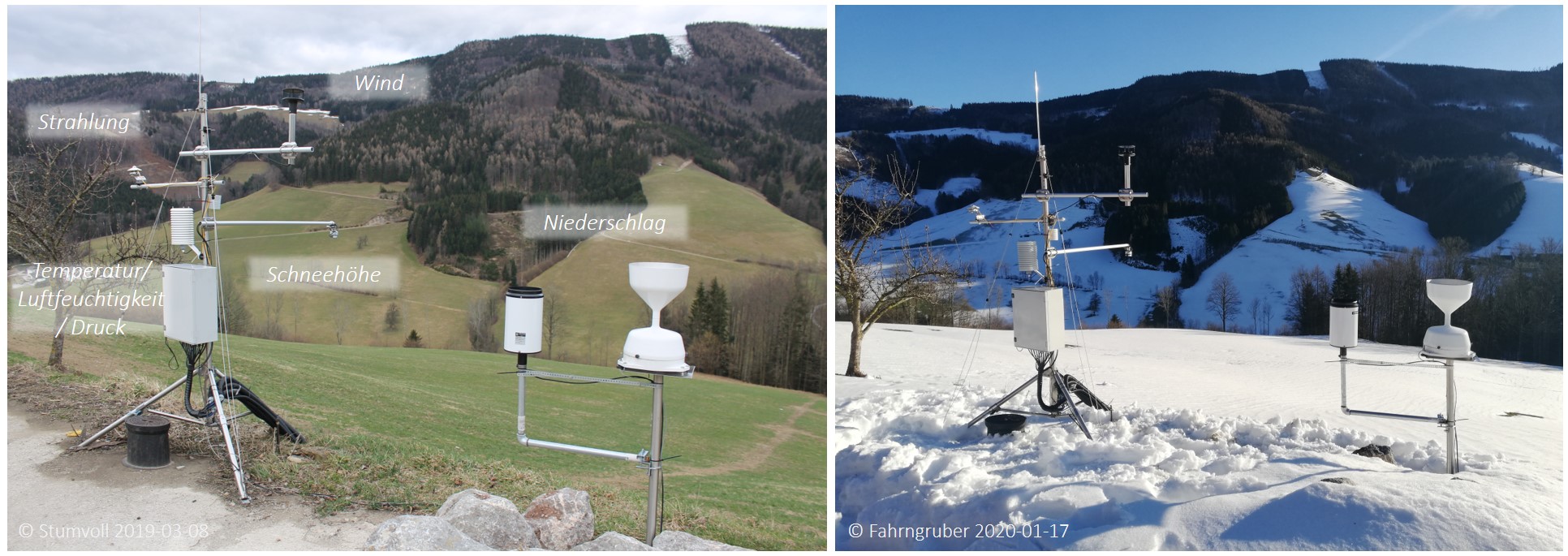
Figure 10: Meteorological station and measuring devices at the Hofermühle site. © Photographs see individual notes.
Terrestrial Laser Scanning (TLS)
The focus of the surface investigation lies on terrestrial laser scanning (TLS). Since November 2015 the Hofermühle has been recorded from the opposite side of the slope using two scanning positions (Figure 11). The campaign intervals are around 3 to 6 months. The focus of the recording is in the autumn and spring months; low vegetation cover and leaveless trees allow the best possible coverage and resolution during this time.
The multi-temporal data is used to create surface difference models (DEMs of Difference (DoDs)). They provide information about the location and magnitude of mass displacements.
Results: Under construction
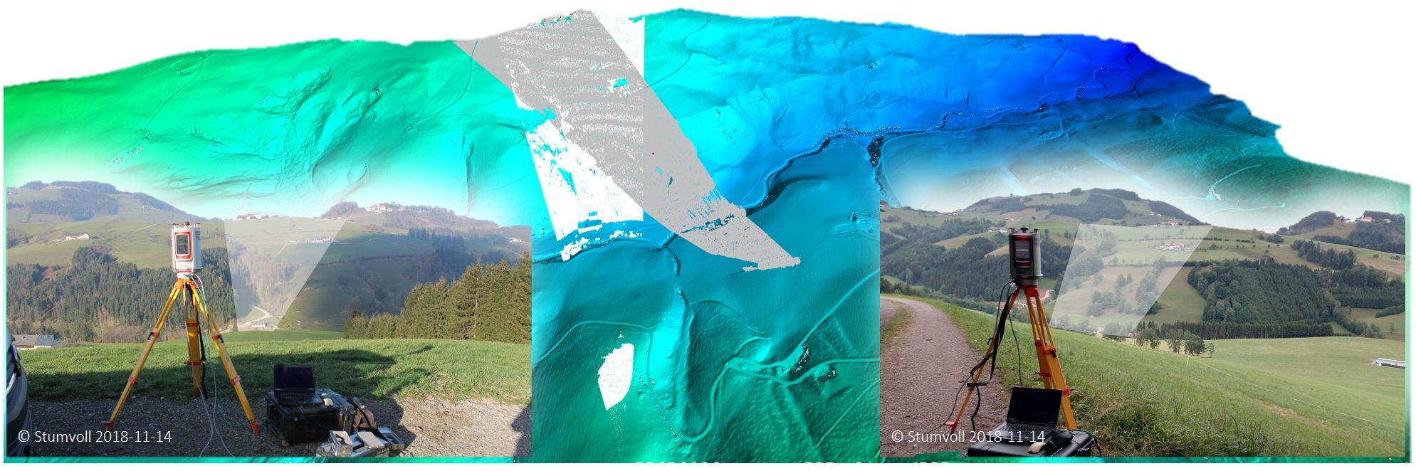
Figure 11: Scan positions and coverage of the multi-temporal TLS campaigns at the Hofermühle site. (DEM (1m) 2009: made available by the Federal State Government of Lower Austria). © Photographs see individual notes. Graphics: Stumvoll M.J. 2019, also in Stumvoll & Glade 2019.
UAV (Unmanned Aerial Vehicle) surveying and SfM (Structure from motion)
Due to shadowed areas in the TLS measurements and for scientific motivation, UAV flights are also carried out parallel to the TLS recordings. The corresponding image material is processed into terrain models and orthophotos via SfM.
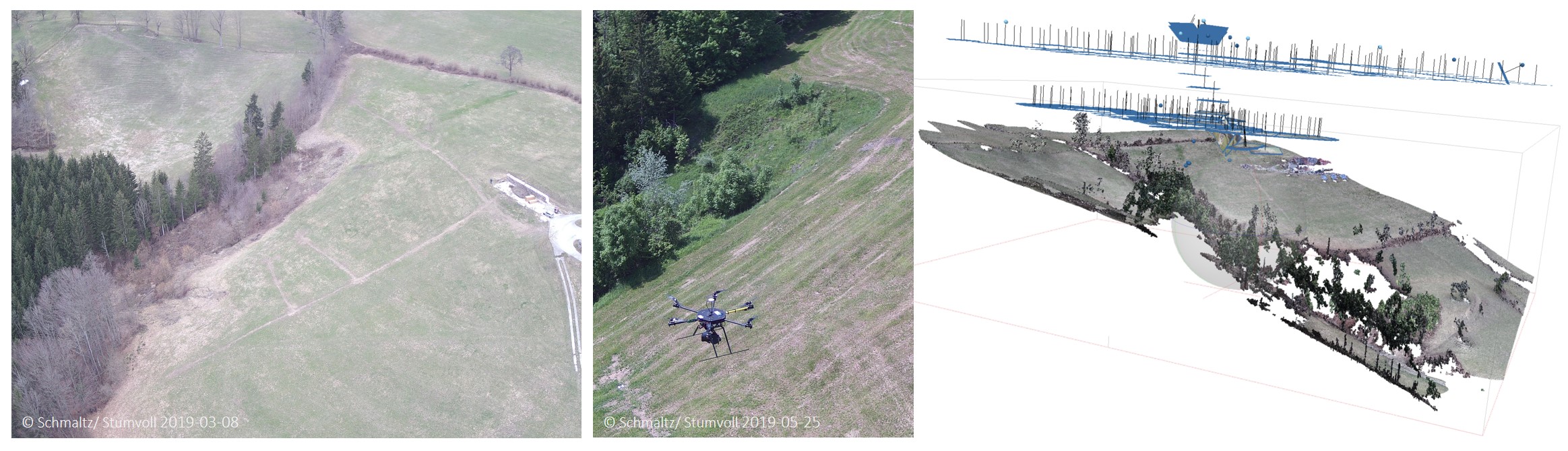
Figure 12: (left and middle) Impressions of the UAV flights at the Hofermühle site, spring 2019. (right) Point cloud display of an aerial image data analysis for March 8, 2019 in Agisoft Photoscan software. (Pilot: Schmaltz E.M.), © For photographs see individual notes. Graphics: Stumvoll M.J. 2020.
GNSS measurements (completed)
With the aim of recording purely surficial movement patterns by means of point measurements, around 60 reference points in the form of marked boulder stones were created at the Hofermühle and buried on the surface. These have been measured about once a month since 2014 using manual GPS measurements. The measurements were discontinued in 2019.
(Geo)morphological mapping
The entire catchment area of the Hofermühl torrent and in particular the active process areas were mapped in detail with respect to (geo) morphological aspects via the evaluation of digital terrain models and numerous intensive site inspections.
Results: under construction