The ENGAGE working group (Geomorphological Systems and Risk Research) at the Department of Geography and Regional Research, University of Vienna, has been conducting a long-term monitoring project to investigate landslides in Lower Austria since 2015. These investigations are part of the NoeSLIDE project, which was created in 2014 in close collaboration between the University of Vienna and the Federal State Government of Lower Austria. The project aims to improve the understanding of landslide dynamics in the region, where detailed knowledge about spatio-temporal slope processes remains limited.
Since its establishment, NoeSLIDE has expanded through collaborations with key national institutions, including the Geological Service of Austria (GeoSphere Austria, formerly Geologische Bundesanstalt, GBA), the Geological Survey of Lower Austria and the Torrent and Avalanche Control (WLV), as well as international partners such as the University of Heidelberg and the Technical University of Vienna (TU Wien). These partnerships have enhanced the ability of the project to investigate, analyze and monitor complex landslide processes using well established, as well as innovative and advanced methodologies, such as geotechnical application and remote sensing techniques.
Landslides are among the most frequent natural hazards occurring in Lower Austria. However, detailed knowledge about the spatio-temporal slope dynamics is less advanced and comprehensively understood. In order to identify and quantify the factors driving the landslide dynamics and their spatio-temporal evolution, a long-term monitoring approach combining punctual and slope distributed surface and subsurface methods is necessary.
The Core Facility "Earth Surface Dynamics Lab (eSurfLab)" at the Department of Geography and Regional Research plays a crucial role in this effort by providing state-of-the-art equipment and expertise for geomorphological monitoring and analysisis.
Although the initial NoeSLIDE project formally ended in 2017 and was extended until 2019, efforts continue to secure follow-up funding for ongoing investigations and monitoring at the sites. The project name "NoeSLIDE" remains in use, reflecting the ongoing commitment to landslide research in the region. Initially, research sites focused on multiple landslide-prone areas in Lower Austria, including:
- An earth flow at Eckerwirt;
- A complex landslide system at Hofermühle, near Konradsheim (Waidhofen an der Ybbs district);
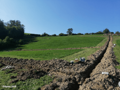
- A potential deep-seated landslide in Brandstatt (Scheibbs district),
- Rockfall and tipping sites at the Ofenlochstrasse;
- The Amtmann natural monument near Opponitz;
- A complex, shallow landslide in Gresten (Scheibbs district) that has been active for over 40 years.
Currently, ongoing investigations and monitoring activities with a focus on Brandstatt, Hofermühle and Gresten have led to the establishment of dedicated Landslide Observatories at these sites. In contrast, research at the other sites have been completed over the years.
To analyze landslide dynamics at the sites, the project focuses on the development and testing of innovative techniques for geo-monitoring. In particular, the project integrates traditional and innovative approaches, such as well-established geotechnical methods (e.g., inclinometers, piezometers and TDR devices), as well as advanced topographic and geophysical methods (terrestrial laser scanning, UAV surveys, Cosmic Ray Neutron Sensing and geoelectric measurements). This approach enhances the identification and interpretation of deformation patterns over the slopes and increases the knowledge on the relationships with triggering factors.
In addition to on-site monitoring, NoeSLIDE aims to develop a web-based platform for real-time visualization and analysis of monitoring data. This platform is expected to provide crucial information for authorities to respond quickly to landslide threats and mitigate potential risks to population and infrastructure. By integrating long-term monitoring with advanced investigation methods, NoeSLIDE continues to contribute valuable insights into landslide processes in Lower Austria. The findings from this project support both scientific research and practical applications in natural hazard management.
Contact:
Univ.-Prof. Dr. Thomas Glade