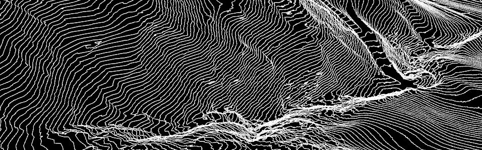
The Brandstatt site, located in the municipality of Gresten (district of Scheibbs, Lower Austria, NE Austria), affects the northern slope of the Lampelsberg in the Austrian Prealps. The slope, as well as the surrounding hillsides, is mainly used as grass- and pastureland by local farmers, as the slope gradient ranges from 15° to 20° (Office of the Lower Austrian provincial government, 1970). The unstable slope has been periodically active since the mid-1960s, characterised by slow continuous movements with phases of accelerations (Marr et al., 2023). Consequently, the landslide activity led to the formation of surface geomorphological features due to the persistent movements with the formation of distinct deformation patterns as well as numerous bulges and depressions (Gottschling, 2001).
Ongoing slope instability in the study area has been documented through technical reports from the Geological Service of Austria (GeoSphere Austria, formerly Geologische Bundesanstalt, GBA). According to previous studies (e.g., Schweigl, 2012), the slope instability affects an area of approximately 20 hectares with recorded measures of displacement rates ranging from 1.5 to 8 cm/yr and an estimated shear surface depth of ~20 m (Schweigl, 2012). Based on these characteristics and existing classifications (Varnes, 1978; Cruden & Varnes, 1996), the landslide is identified as a potential deep-seated, slow-moving earth slide system (Marr et al., 2023).
Similar to the other sites of the NoeSLIDE project, the Brandstatt landslide is located in the complex geological transition zone between the Flysch and the Gresten-Klippen Units and the Northern Calcareous Alps, which represent the main predisposing factor in landslide activity in the region (Petschko et al., 2013; Stumvoll et al., 2022; Marr et al., 2023). In addition, deposits belonging to the Molasse Unit have been documented in the area (Lotter and Jochum, 2010). According to the available documentation, the middle and upper sections of the slope contain a mix of sandstone blocks and deeply weathered, soft clay slates from the Gresten-Klippen Unit. In contrast, the lower section is composed of clastic and carbonate sedimentary rocks from the Molasse Unit, including dark-grey marls, yellowish sandstones, and grey sandy limestone. These lithological formations are overlain by thick layers of heavily weathered, loamy material (Office of the Lower Austrian Provincial Government, 1970; Gottschling, 2001; Lotter and Jochum 2010). The presence of these lithologies drives the susceptibility to landslide processes as these are prone to water infiltration, accelerating weathering and reducing their stability as carbonate content diminishes (Gottschling, 2001). In addition, heavy rainfall and snowmelt contribute to the increasing pore water pressure, which leads to progressive slope failure and the continued evolution of the landslide (Marr et al., 2023).
The study site is representative of documented slope instabilities in the surrounding hillsides, which have been known to be unstable for decades (Lotter and Jochum, 2010). Surface movements were first recorded here in the 1960s, prompting the installation of drainages by the agricultural district authority to stabilize the area (Office of the Lower Austrian Provincial Government, 1970). Additional drainage measures were implemented in 1982/83, yet significant reactivations occurred following intense rainfall in 1985 and 2001, leading to stepped terrain sinking of up to 30 cm (Hinteregger 1985; Gottschling, 2001). Further deep drainages were subsequently installed to mitigate instability (Gottschling, 2001).
The Brandstatt site has been part of the NoeSLIDE monitoring project since 2022, where a variety of advanced methods are used to study the landslide dynamics. In collaboration with the ENGAGE group from the University of Vienna, extensive fieldwork has been conducted to establish the landslide observatory (Figure 27). The installed sensors aim at increasing our understanding of the mechanisms driving the landslide dynamics through innovative landslide monitoring and research approaches, involving detailed data collection and site assessments. More information on subsurface and surface monitoring approaches can be found in the dedicated sub-tabs.
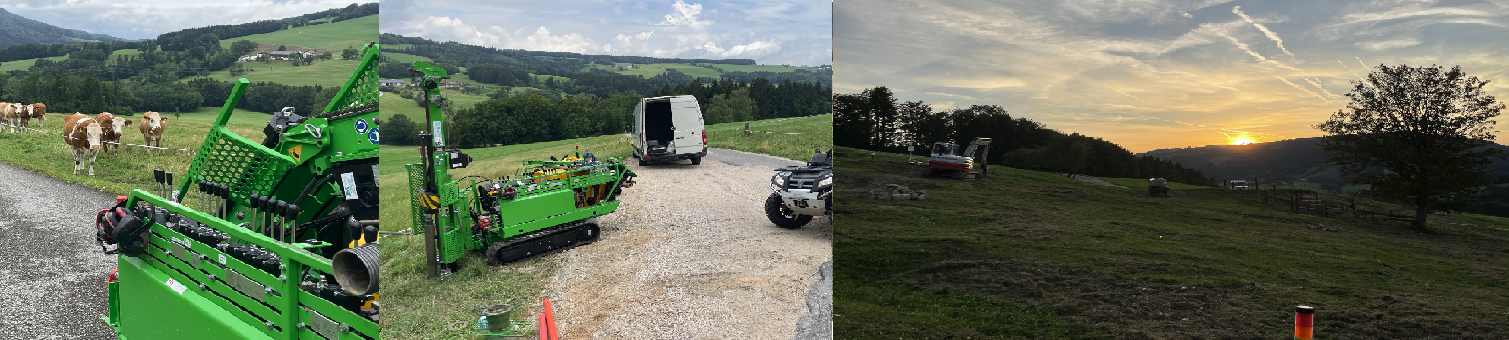
Figure 28: Images from the fieldwork activities conducted by members of the ENGAGE group of the University of Vienna during the establishment of the landslide observatory since 2022 (images courtesy of R. Kanta).
Literature
Cruden, D.M., Varnes, D.J., 1996. Landslide Types and Processes. Landslides: Investigation and Mitigation. Transportation Research Board Special Report.
Gottschling, P. 2001. Geologisches Gutachten BD1-G-867/1. Landesbaudirektion – Geologischer Dienst. Katastrophenerhebungsblatt. Intern report.
Hinteregger. 1987. Geologisches Gutachten BD-G-867. Landesbaudirektion – Geologischer Dienst. Katastrophenerhebungsblatt. Intern report.
Lotter, M., B. Jochum. 2007. Geophysikalische und ingenieurgeologische Methoden zur Untersuchung von durch Massenbegweungen bedingte Bauschäden in Niederösterreich.
Fallstudie Scheibbs (NÖ). Office of the Lower Austrian provincial government. 1970. Gutachten. BD-96-G-1970. Intern report.
Marr, P.; Jiménez Donato, Y.A.; Carraro, E.; Kanta, R.; Glade, T. The Role of Historical Data to Investigate Slow-Moving Landslides by Long-Term Monitoring Systems in Lower Austria. Land 2023, 12, 659. https://doi.org/10.3390/land12030659
Petschko, H., Bell, R., Leopold, P., Heiss, G., Glade, T., 2013. Landslide Inventories for Reliable Susceptibility Maps in Lower Austria, in: Margottini, C., Canuti, P., Sassa, K. (Eds.), Landslide Science and Practice. Springer Berlin Heidelberg, Berlin, Heidelberg, pp. 281–286. https://doi.org/10.1007/978-3-642-31325-7_37
Schweigl, J. 2012. Abschlussbericht BD1-G-411/011-2009. Amt der Niederösterreichischen Landesregierung. Geologischer Dienst. Intern report.
Stumvoll, M.J., Schmaltz, E.M., Kanta, R., Roth, H., Grall, B., Luhn, J., Flores-Orozco, A., Glade, T., 2022. Exploring the dynamics of a complex, slow-moving landslide in the Austrian Flysch Zone with 4D surface and subsurface information. CATENA 214, 106203. https://doi.org/10.1016/j.catena.2022.106203
Varnes, D.J. 1978. Slope movement types and processes. Special Report 176: Landslides: Analysis and Control (eds: Schuster, R.L., Krizek, R.J.). Transportation and Road Research Board, National Academy of Science, Washington D.C., pp.11-33.
")
")